Mapping and database

We design a database-related mapping (excell or GIS)
After a tree inventory, we create a mapping of the trees diagnosed.
The mapping is created via a GIS geographic information system.
All the data is identified on a map, via aerial photographs and geo-referenced data. The aerial photographs come from sources such as: IGN digital orthophotography and IFN, National Institute of Geographical and Forestry information and other sources of geographical information… etc.
Upon request (and additional cost), part of the tree inventory, trees can be geolocated very precisely by their X-Y coordinates, via the use of a high-precision GPS.
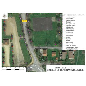
Example of GIS mapping


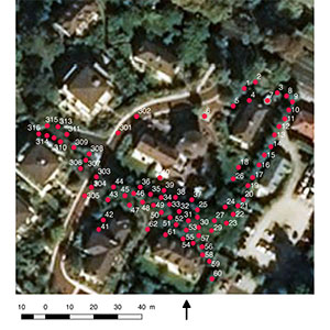
Opposite picture: Example of a mapping of trees diagnosed on site.
Colour correspond to tree species and each tree is numbered. This allows to find all the characteristics of a tree in the database.
Thus, a data table refers to each tree that is diagnosed and identifiable on the map. This database is made in an Excel sheet and can be exploited via GIS software.
The GIS system offers the advantage to allow specific selections in the database. For example, it is possible to display only trees that require pruning or to display all trees with sanitary problems.
However, trees requiring work are also identified on site by a mark, in order to avoid any mistakes.

 (33)07 60 50 08 70


